Presentations
Our Environment of Light: An Interdisciplinary Survey Course
Association for Environmental Studies and Sciences Annual Conference, July 2020
Finding Your Roots: Understanding America’s Immigrant History Through Genealogy
Bucknell Digital Scholarship Conference, October 2018
Open Educational Resources for Community Service with Web-Based Geographic Information Science and Technology
NERCOMP Professional Development Opportunity on OER: Obtaining Exceptional Results, College of the Holy Cross, February 2018
Cities, Schools, and Highways Powerpoint PDF
Institute for Social Science Research, University of Massachusetts Amherst, December 2015
Research Computing at Amherst College
Future Directions in Research Computing in the Northeast, Waltham MA, September 2015
Community Service with Web-Based Geographic Information Science and Technology (GIST): Blended Pedagogies for the Twenty-First Century
Five College Blended Learning Institute, Amherst College, May 2015
Supporting Ebola First Responders
HackEbola, University of Massachusetts Amherst, November 2014
News: HackEbola at UMass Aids Fight Against West African Epidemic
Cities, Schools, and Space: Successes, Failures, Lessons Learned Powerpoint PDF
Student-Faculty Research Collaboration in the Humanities and Social Sciences, Amherst College, December 2012
Spatial Humanities in the Five Colleges Powerpoint PDF
GIS and Spatial Thinking in the Undergraduate Curriculum, Bucknell University, November 2012
Assessing the Impact of the Inner Belt: The Local Community, MIT, and the Housing Market
—
Teaching Workshop: Using Local and Regional History in History and Foundations Classrooms
—
HES Digital Drop-In Session: Online MappingHistory of Education Society Annual Meeting, Seattle WA, November 2012
Making Census of Cambridge, Massachusetts: Schools, Highways, and Historical GIS Powerpoint PDF
NEArc Spring Conference, Smith College, May 2012
Elementary School Construction in Cambridge, 1960-1979: Reconstructing the Role of Space, Race, and Class in School Assignment Decisions
Social Science History Association Annual Conference, Boston MA, November 2011
Cities, Schools, and Space (Long Talk) Powerpoint PDF
NEArc Fall Conference, Saratoga Springs NY, November 2011
Cities, Schools, and Space (Lightning Talk) Powerpoint PDF
NEArc Spring Conference, Smith College, May 2011
Cityscapes: An Online Discovery Tool for Urban and Cultural Studies Powerpoint PDF
CGA Conference on Geospatial Collaboration: New Common Ground, Harvard University, May 2011
Cities, Schools, and Space: Collaborative Research as Pedagogy Powerpoint PDF
Liberal Arts Education, Collaborative Research, and the Humanities, Swarthmore College, April 2011
Cityscapes: An Online Discovery Tool for Urban and Cultural Studies Powerpoint PDF
ICT Summit, University of Massachusetts, March 2011
GTiler: A Python Script to Generate Google Tiles From a Georeferenced Image Movie PDF
GeoDev Meet-Up, Boston MA, December 2010
Building Historical Maps for Cityscapes,
An Online Discovery Tool for Urban and Cultural Studies Movie PDFNEArc Annual Conference, Newport RI, November 2010
Circles (●) and Squares (■) and Diamonds (◆), Oh My!
NEArc Spring Conference, Smith College, May 2010
GIS, Gratis: Free Clients for Web Mapping Services
NITLE Geospatial Technologies in the Liberal Arts Conference, Skidmore College, September 2009
Open Sesame: Open Source GIS Servers, Databases, and Clients
NITLE Geospatial Technologies in the Liberal Arts Conference, Skidmore College, September 2009
Creating Cartograms: Making Geographic Areas Speak Volumes
NEArc Spring Conference, Smith College, May 2009
Moran's I: Are Those Clusters Random or Meaningful?
Skidmore Regional GIS Conference, January 2009
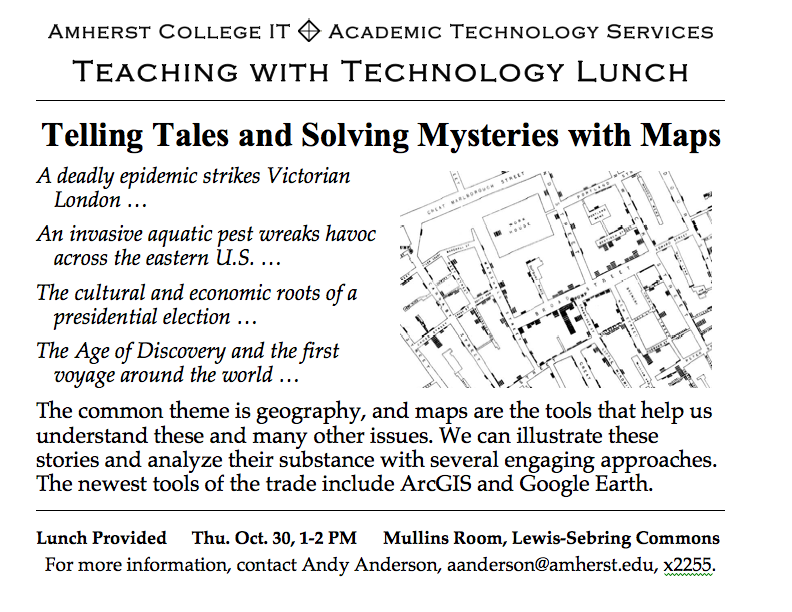
Telling Tales and Solving Mysteries with Maps:
- New World Explorations, an example of a presentation using Google Earth
- The Presidential Election of 2004, an example of cartograms in a PDF
Teaching and Technology Lunch for Amherst College Faculty, October 2008
Introducing GIS via College-Sponsored Community Service Activities
NEArc Fall Conference, Burlington, VT, November 2007