Geographic Information Systems (GIS) are a set of computer programs that can organize, display, and analyze spatially distributed data. At its simplest, GIS is "mapping", providing a geographic arrangement of diverse information, allowing for visual comparison. Such maps are therefore a powerful means to educate, in class and in publications. GIS has been applied in geology, biology, psychology, anthropology, sociology, linguistics, history, political science, economics, and many other fields.
Simple Mapping
Working with spatial information is generally more complicated than other data, but we provide access to ArcGIS Online, which makes the technology simpler to use. It allows easy generation of Web-accessible, interactive maps from simple spatial information, and the possibility of using them within a variety of slide-show-like “story maps”, such as Welcome to the Amazon from the course GEOL-109 Climate Change, Global Warming and Energy Resources. Combined with off-the-shelf basemaps and a collection of other available data sets, it can quickly get you mapping! Projects can be collaborative and shared privately or publicly.
Note: please contact askIT@amherst.edu to request an upgrade to your account for full access to all of ArcGIS Online’s features, or to request a quick orientation to its use, or to arrange a class workshop.
ArcGIS Software
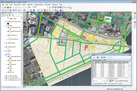
ArcGIS is general-purpose industry-standard software that not only maps data but provides many means to transform it for other purposes. Its tools can extract related features, provide geostatistical analysis, and generate 3D models and movies of time-dependent changes.
- ArcGIS is available on all Windows computers in most campus computer labs, as well as on classroom projection computers.
- Current students, faculty and staff also have access to ArcGIS online.
- Students, faculty, and staff can install ArcGIS on any College-provided Windows computer, from the Amherst Software drive.
QGIS Software
QGIS is free open-source software for geospatial applications (FOSS4G) that is also quite powerful and has a good support community worldwide. It is somewhat harder to use than ArcGIS, but it is cross-platform, so if you want to run GIS on a Macintosh or Linux computer, it’s recommended.
Training, Help, and Other Resources
Direct Support
Faculty or students seeking support in using GIS can contact Andy Anderson, or submit an AskIT ticket.
Course Materials and Training
- Amherst College’s Introduction to GIS, which contains a wealth of information to help learn the fundamentals of GIS, using ArcGIS. Short courses using this documentation are offered in person at least twice a year.
- A number of tutorials for ArcGIS in the form of Adobe Acrobat (PDF) digital books are available on the College network at K:\Maps\ArcGIS Books-n-Data\Documentation
- Amherst College's license for the ArcGIS software includes a number of online courses prepared by ESRI.
- GIS for Geoscientists is a course from Hamilton College oriented towards geoscience majors.
Other Help Resources
- ArcGIS Help: ESRI's on-line documentation.
- ESRI’s useful collection of tips and shortcuts for the Arc software.
Data Sources
Data sources are numerous, but here’s some recommended starting points:
- K:\Maps contains a great deal of data that can be used as the foundation for your own maps.
- The Amherst College Library maintains a Web page of GIS resources, including links to the GIS books in the library's collection.
- ArcGIS Online provides many data sets that can be used with its own mapping platform but also downloaded for use in desktop GIS software.
- The Town of Amherst provides a lot of local geographic data.
- MassGIS is the primary source of Massachusetts geographic data.
- The National Map provides US geographic data.